Download CV Home

i am
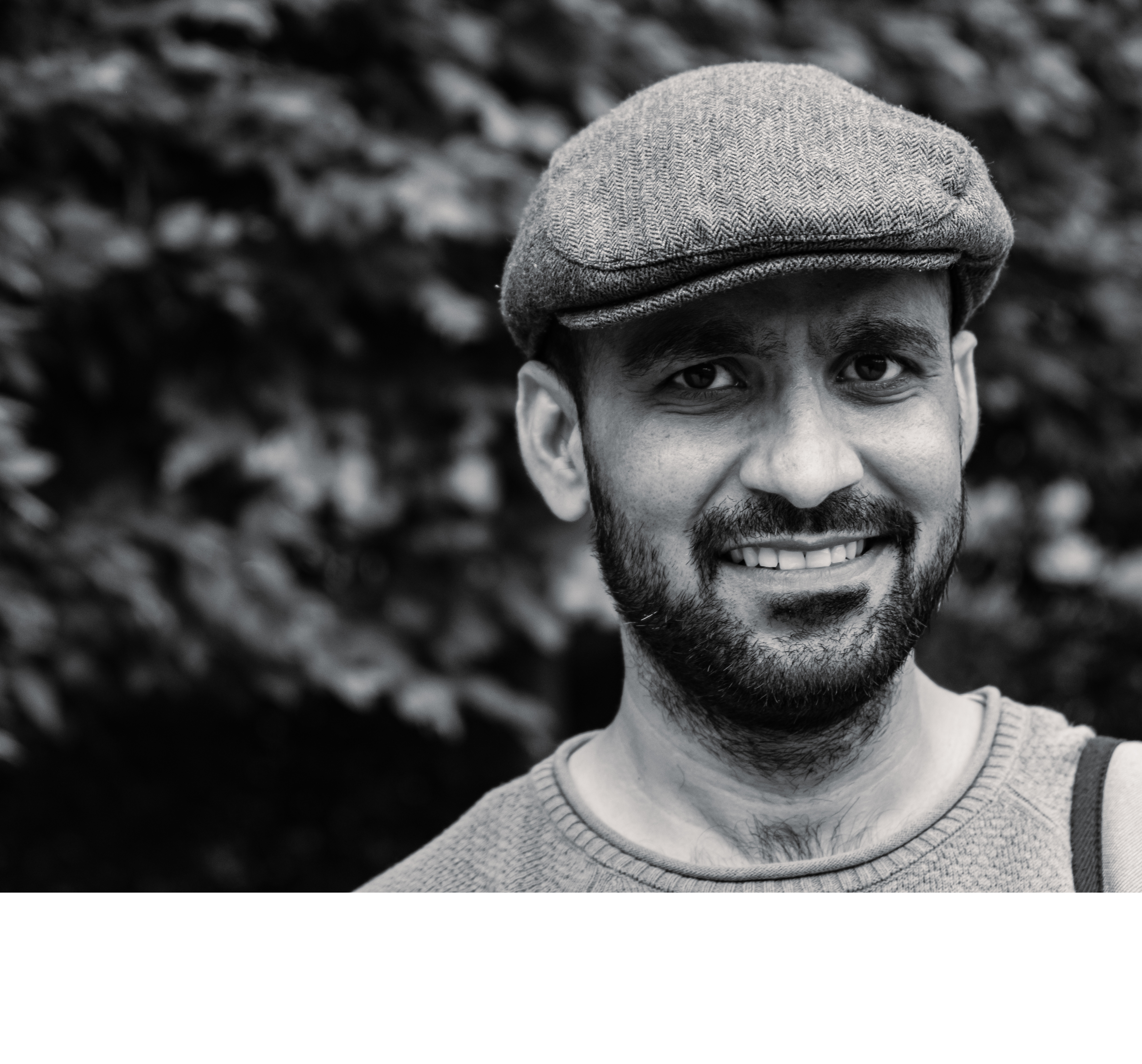
Amit Daiman

Remote Sensing, Geoinformatics and Hydroinformatics Expert

about me

As an experienced professional, I am passionate about the transformative power of remote sensing and GIS applications in agriculture, water management, and forestry. With a track record of successfully delivering expert lectures, GIS services, and specialized knowledge, I am committed to environmental protection and sustainable development.

Motivated and pragmatic professional with a solid track record of over 9 years as a Remote Sensing, Geoinformatics, and Hydroinformatics Expert. Adept at harnessing satellite data and conducting fieldwork in challenging terrains, including forests, tribal and rural areas, for resource mapping. Proficient in translating complex data into valuable maps for applications spanning water resources, agriculture, forestry, and environmental studies. Possesses strong research, teaching, and technical skills. A proven collaborator, experienced in working across interdisciplinary teams with scientists, engineers,and policymakers to tackle complex environmental challenges.

Mobile

9875842709

email

daimanamit@gmail.com

education

2019 - 2021

MS of Hydroinformatics

IHE Delft Institute for Water Education

Delft, The Netherlands

Hydrology and hydraulics, Information Technology and Software Engineering, Modelling Theory and Computational Hydraulics, Modelling and Information Systems Development, Computational Intelligence and Operational Water Management, River Basin Modelling, Urban flood management and disaster risk mitigation, Flood risk management, Remote sensing for agricultural water management.

2010 - 2012

MSc of Remote Sensing and Geoinformatics

Maharshi Dayanand Sarswati University

Ajmer, India

Remote Sensing, Geographic Information System, Computer Programming, Digital Image Processing, Microwave Remote Sensing, Geodesy, Digital Cartography, Geoinformatics, Geomorphology and Space Science, Climatology and Space Science, Digital Photogrammetry etc.

2008 - 2010

MA / MSc of Geography

University of Rajasthan

Jaipur, India

Physical Geography, Climatology, Geomorphology, Oceanography, Soil Science, Agriculture Geography, Economic Geography, Water Resources Management, Statistical Method for Geography etc.

CERTIFICATIONS AND TRAININGS

1. Introduction to GIS for Water Science & Engineer-ing, IHE, Delft, Netherlands (2019).

2. GIS & Remote Sensing for Application of Water, IHE Delft, Netherlands (2018).

3. ArcGIS Desktop Advance, Remote Sensing Applica-tion Centre, MP Council of Science & Technology Bhopal, India (2018).

4. ERDAS IMAGINE Professional, Vector and Virtual GIS, Intergraph Geospatial, Bhopal, India (2012).

5. UN CC: Introductory E-Course on Climate Change, United Nations Institute of Training Research (2017).

6. Monitoring Climate From Space, ESA (2016).

7. Getting Started with GIS, ESRI (2016).

8. Editing in ArcGIS Desktop, ESRI (2016).

9. Geographic Coordinate System, ESRI (2011).

skills

Remote Sensing: Google Earth Engine, Erdas Imagine, ENVI, SNAP, Google Colab.

90%

Programming and Cloud Computing: Python, R, JavaScript (GEE), Git, GDAL, Jupyter Notebooks, Machine Learning for image classification, HTML, CSS.

75%

Water Science: HEC-RAS, MIKE (Zero, 11, 21, Urban, Flood, Mouse) , MODFLOW, SWAT.

75%

Graphic Design and Software: Adobe Photoshop, Adobe Illustrator, Adobe InDesign.

70%

GIS & Web GIS: ArcGIS Pro, ArcGIS Desktop, Geoserver, QGIS, GRASS, SAGA, Google Earth Pro.

90%

Communication: Technical report writing, Data visu-alization, Presentation skills, Ethical Communication.

85%

Project Management: Planning, execution and monitoring of remote sensing and GIS projects.

97%

Data Analysis and Tools: GPS, DGPS, Statistical analysis, Spatial statistics, Data mining, Professional photography, Field survey.

90%

AREA OF EXPERTISE

Satellite Remote Sensing (RS) | GIS Mapping | Flood, Catchment and Groundwater Modeling | Machine Learning | Spatial Data Science | Hydroinformatics | RS GIS for forestry, Agriculture and Water | Project Management | Technical Report Writing | Data Visualization | Cross-Disciplinary Collaboration | Citizen Geospatial Science | Sustainable Development.

ORGANIZATIONAL ASSOCIATIONS

1. Honorary Scientific Advisor | Institute for Ecology and Livelihood Action (IELA), Udaipur, India | [February 2023 – Current].

2. Scientific Resource Person | Department of Science and Technology, Government of India | [November 2018 – Current].

3. Honorary member | Indigenous and Conserved Communities Area (ICCA) Consortium, Helsinki, Finland | [October 2018 – Current].

4. Course Coordinator and Instructor | INGEOEXPERT, Spain | [June 2022 – Current].

5. Member | Indian Society of Geomatics - ISRO | [December 2010 – Current]

experience

  • 05/2021 – Current

    FREELANCER (SCIENTIST AND ACADEMICIAN)

    N/A

    N/A

    Accomplishments include providing extensive training in remote sensing, introducing 'Citizen Geospatial Science,' and leading projects integrating community knowledge for ecosystem assessment, wildlife habitat mapping, water resource management, and conservation efforts.

  • 10/2020 – 03/2021

    MS HYDROINFORMATICS THESIS

    IHE DELFT INSTITUTE FOR WATER EDUCATION

    Delft, Netherlands

    Thesis Title: Assessing and analysing desertification in the Chambal River Basin (CRB) using remote sensing and machine learning.

    10/2020 – 03/2021

    MS HYDROINFORMATICS THESIS

  • 10/2013 - 08/2019

    SRF, JRF and GIS ASSISTANT

    REMOTE SENSING APPLICATION CENTRE, MP COUNCIL OF SCIENCE AND TECHNOLOGY

    Bhopal, India

    In a multifaceted career, I've made significant contributions to various projects spanning hydrology, climate change, Integrated Water Resources Management, and disaster response. Utilizing advanced remote sensing data, I've optimized water usage and agricultural practices. I've also played a vital role in state biodiversity initiatives, environmental feasibility assessments, property status searches, and educational mapping, demonstrating expertise in remote sensing and GIS data for diverse applications, from land use to evapotranspiration.

  • 01/12/2018 – 15/12/2018

    VISITING RESEARCHER

    NORTH EAST SPACE APPLICATION CENTRE, INDIAN SPACE RESEARCH ORGANISATION (NESAC - ISRO)

    Shilong, India

    Enabled sericulture development by conducting site suitability analysis and mapping of silkworm and food plants using remote sensing and GIS. Optimized locations for sustainable growth. By utilizing weighted overlay and analyzing meteorological data.

    01/12/2018 – 15/12/2018

    VISITING RESEARCHER

  • 02/2013 – 08/2013

    RESEARCH TRAINEE

    CENTER FOR POLICY STUDIES

    Delhi, India

    Contributed to the Madhya Pradesh Resource Atlas Program as a Remote Sensing and GIS analyst. Conducted geostatistical analysis and created diverse resource maps for district resource atlases.

  • 04/2012 – 09/2012

    INTERN (MSC REMOTE SENSING & Geoinformatics THESIS)

    REMOTE SENSING APPLICATION CENTRE, MP COUNCIL OF SCIENCE AND TECHNOLOGY

    Bhopal, India

    Thesis Title: Integrated GIS Modeling for Exploring Groundwater Potential Using Morphometric and Hydro-Geomorphological Studies.

    04/2012 – 09/2012

    INTERN (MSC REMOTE SENSING & Geoinformatics THESIS)

TEACHING EXPERIENCES/ RESOURCE PERSON/ INVITED TALK

1. Instructor and Course Coordinator: Developed and conducted a fifty-hour course for INGEOEXPERT Training Centre, Spain [2022].

2. Guest Lecture: Trained police officers in 'Use of Space Technology in Policing' at Rajasthan Police Academy, Jaipur [Feb 2023].

3. Guest Lecture: ‘Basics of Remote Sensing and GIS’ to M.Sc. Geology students at MPCOST, Bhopal, India [2018].

4. Evaluator, National Children Science Congress, Ministry of Sci & Tech: Evaluated research projects in Delhi [Sep 2023] & Rajasthan [Nov 2018].

5. Master Resource Scientist: Trained teachers on 'Eco-Eureka Kit' in RSCERT, Udaipur under DST - GoI [9-13 Sep 2023].

6. Master Resource Scientist: Provided training to science students and teachers on remote sensing, GIS, and hydroinformatics during the 'Summer Research Camp' organized by DST, Govt. of India [2023].

7. Master Resource Scientist: Involved in ‘Script Writing’ for science kit under DST - GoI [13-18 August 2023].

8. Subject Matter Expert, Science Centre Madhya Pradesh, Gwalior - Development and Duplication of Eureka project [23/05/2019].

9. Resource Person: Delivered a lecture on Earth Observations and IT at the State Level Training Programme jointly organized by the Commissionerate of College Education, Government of Rajasthan, and Maharana Pratap Government College, Chittorgarh, India - 2021.

10.Resource Person: ‘Recent Trends in Geography’ at the International Webinar on Research at Govt College Bundi, Rajasthan, India - 2020.

11.Resource Person: ‘Recent Trends and Applied Aspects’ at international webinar organized by Govet College Deoli, Rajasthan, India - 2020.

12.Co-chair and Speaker: Lectured on Applications of Remote Sensing and GIS in Forestry in International Webinar on Biodiversity Conservation and Sustainable Development Organized by Govt. Madhav Sadashivrao Golvalkar College, Rewa and IQAC [28-29 Aug 2023].

13.Speaker: SAGE University Bhopal- Delivered lectures on Exploring Life in Water through Remote Sensing and GIS [22/08/2023].

14.Speaker: "Fundamentals and Applications of Remote Sensing and GIS" at the national seminar on 'Applications of RS & GIS and career opportunities' organized by Government College Ajmer (GCA), Rajasthan - 2023.

15.Online Talk: ‘Fundamentals and Applications of Remote Sensing and GIS in Ecosystem Study’ session at the state-level National Children Science Congress (NCSC) 2022, organized by Science Centre Madhya Pradesh.

16.Invited Talk: ‘Role of Space Technology’ at workshop on Conservation of the Community Conserved Areas in Jodhpur, India - 2017.

SCHOLARSHIPS, HONORS AND AWARDS

1. OKP Fellowship, Ministry of Foreign Affairs, The Netherlands - MS in Hydroinformatics from IHE Delft [13/10/2019].

2. National Young Scientist Award, Rajasthan Geographic Association, India - Presented research paper [12/01/2019].

3. OKP Fellowship, Ministry of Foreign Affairs, Netherlands - Completed GIS and Remote Sensing course at UNESCO-IHE [29/10/2018].

4. Certificate of Excellence, Science Centre Gwalior and DST GoI - Regional training workshop at RSCERT, Udaipur, Rajasthan [13/09/2023].

5. Appreciation, Additional Director General of Police, Madhya Pradesh - Completed Dial 100 project [07/10/2017].

6. Appreciation, Maharana Pratap Govt. College, Chittorgarh - Established GIS and Remote Sensing Laboratory [2018].

7. Appreciation, RSAC - MPCOST, Bhopal - Participation in the National Science Congress on Energy [31/12/2013].

8. Appreciation, Maharana Pratap Govt. College, Chittorgarh - Delivered lecture on Earth Observations and Information Technology [2021].

9. Appreciation, Prashansa foundation Gujrat and Directorate of Education UT Administration-'Summer Research Camp' [17-23/05/2023].

10. Appreciation, SAGE University Bhopal- Delivered lectures on Exploring Life in Water through Remote Sensing and GIS [22/08/2023].

11. Honorary membership, ICCA Consortium, Helsinki, Finland - Recognized as a member [22/10/2018].

12. Guest of Honor, UNICEF and WHO - COVID-19 honor campaign participant [24/12/2022].

contact me

Amit Daiman

Remote Sensing, Geoinformatics and Hydroinformatics Expert

phone

9875842709

email

daimanamit@gmail.com

website

www.amitdaiman.com